
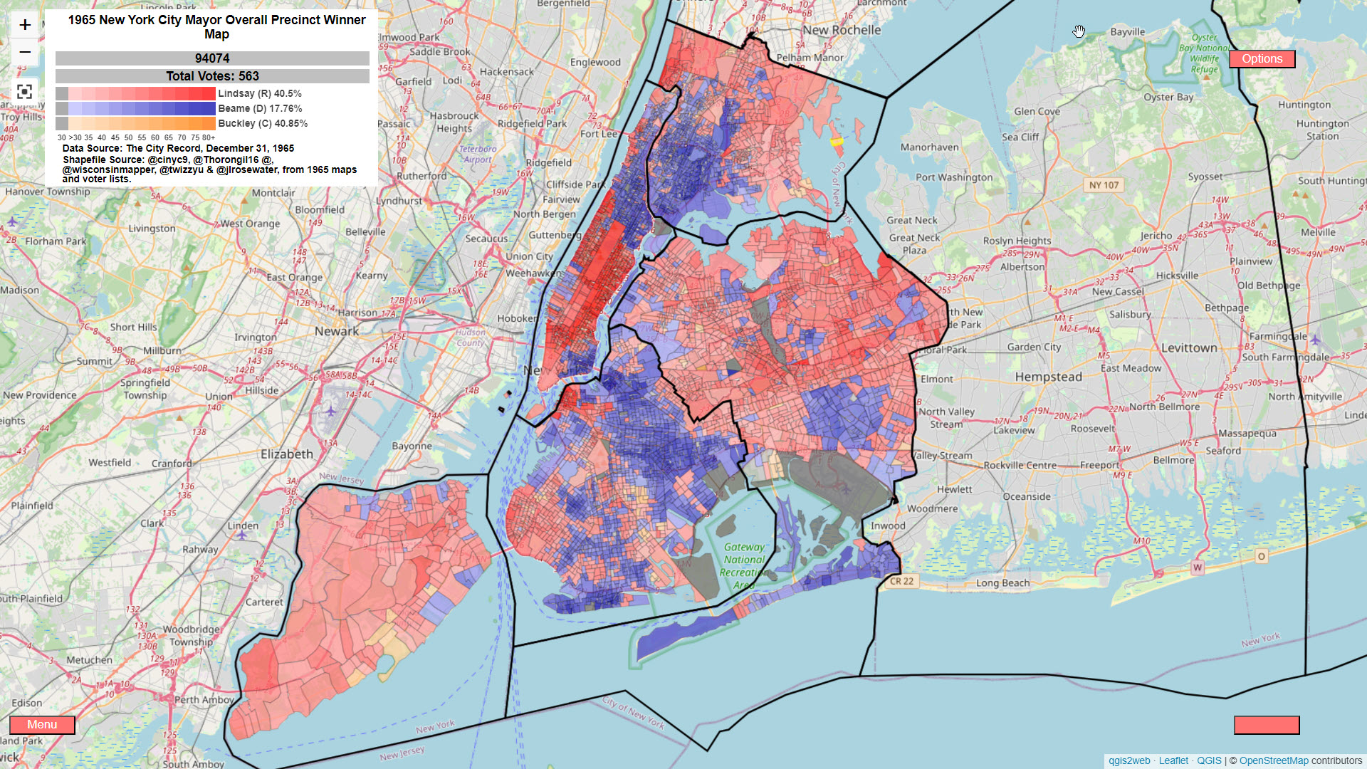
NYC 1965 Multimap
Click the Menu button to change to change to candidate heatmaps and Assembly District Winner Map.- Written by cinyc
- Hits: 2240
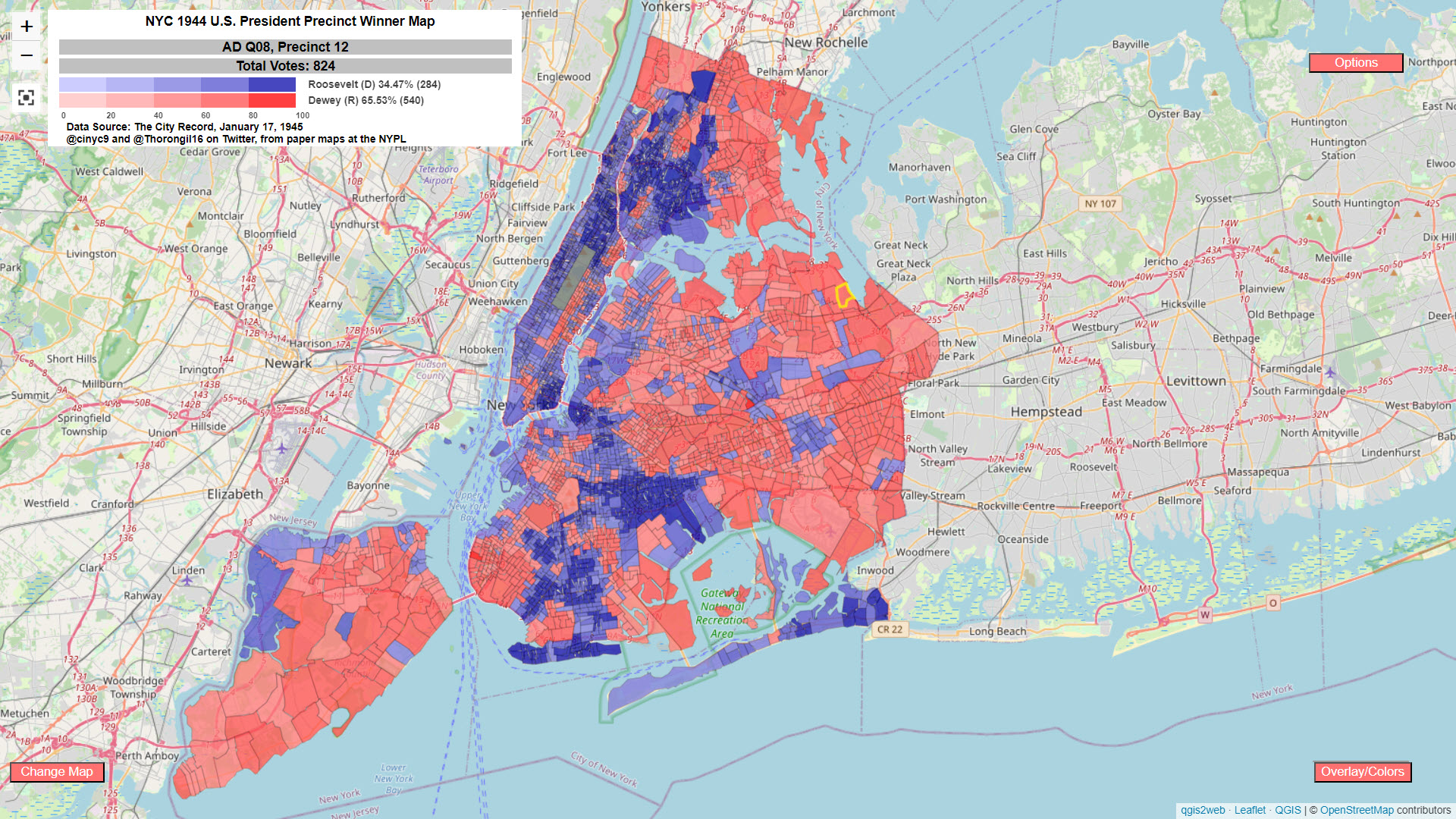
NYC 1940s Map
Please be very patient to allow the map to load.
***Hit the Menu button to see heatmaps, 1946 Governor and 1944 and 1946 Congressional maps. Click on CD Outline to turn on CD borders.***
***Due to the shape and size of some precincts, you might need to zoom in to select smaller precincts.***
- Written by cinyc
- Hits: 4226

Westchester County, NY 2022 GE Elections Multimap
Hit Menu to change what's mapped.
Made with Leaflet, QGIS & qgis2web plugin.
- Written by cinyc
- Hits: 3151
New York 2022 General Election Ballot Tracker Map
Hit Menu to change what's mapped.
-Cumulative Early shows % of County RVs voting Early (June 22 reg stats) -Cumulative vs. SW shows which counties are outpacing the statewide RV % - Blue = underperform; Red = overperform -Cumulative vs. 2020 shows % of County 2020 early votes - where available -Daily shows daily stats -Dated tabs are for archived daily reportsMade with Leaflet, QGIS & qgis2web plugin.
- Written by cinyc
- Hits: 5036
NY-10 & NY-12 8-23-22 Democratic Primary Results Map
***Default map is of the NY-12 Primary. Click Menu-->NY-10-->Winner (or whatever) to see the NY-10 map
Map should auto-update every 2 minutes on election night. There is no need to refresh it.
- Written by cinyc
- Hits: 12933